Irrigation canal maintenance in western Nebraska is taking a giant step forward thanks to an innovative, non-invasive method by Husker geoscientist Mohamed Khalil to check canal integrity. His sophisticated time-lapse analysis pinpoints canal seepage and structural settlement far more accurately and efficiently than traditional approaches — using a technology that can have wide-ranging uses statewide for agriculture, industry and natural resources management.

Safeguarding the structural integrity of irrigation canals is vital to the economic health of western Nebraska, where the canals have supported agricultural production since the 1890s.
Khalil’s focus was the Sutherland Supply Canal that is managed by the Nebraska Public Power District and runs from Lake Ogallala to the Sutherland Reservoir in Keith and Lincoln counties. Seepage potential for the canal has long been a concern, and NPPD provided Khalil, an assistant geoscientist with the University of Nebraska–Lincoln’s Conservation and Survey Division and the Panhandle Research, Extension and Education Center, a $53,184 grant to conduct the structural analysis.
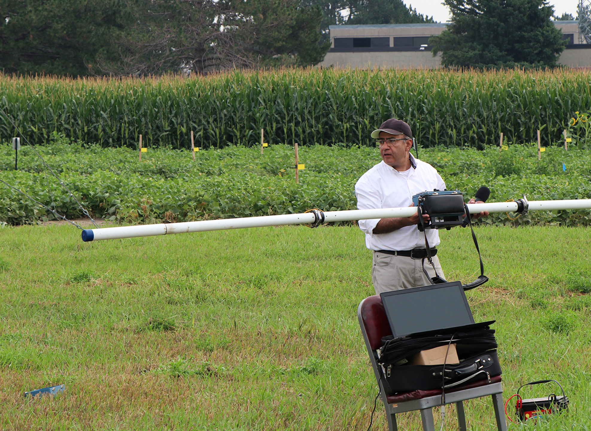
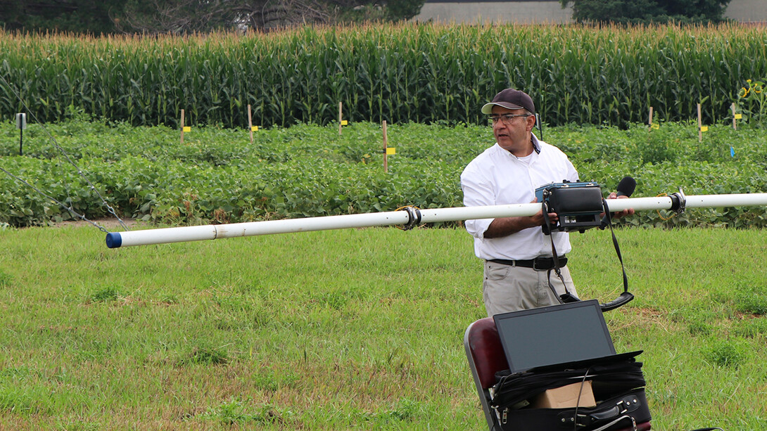
Khalil, as part of his work for the Conservation and Survey Division, oversaw installation of 513 electrodes in various test areas along the lower North Platte and South Platte rivers to the southeast of Lake McConaughy. He then injected current into the ground to measure the subsurface electrical resistance over time.
“The process started in the field by collecting high-quality data,” Khalil said. “We can collect thousands of data points within two to three hours.”
Advanced mathematical processing of the data identified seepage zones by comparing conditions from when the canal was full (August 2023) to when it was empty (October 2023).
Khalil’s time-lapse approach rests on a fundamental geophysical principle: Water and moisture increase the ground’s electrical conductivity.
By using advanced software and computational power to analyze the naturally occurring voltage differences, he created two-dimensional images of the subsurface highlighting seepage areas. The analysis showed how the path and volume of seepage plumes change with different seasons and canal usage.
He and his coauthors published their findings this year in a paper of the Journal of Applied Geophysics, and NPPD is using the findings for its canal maintenance.
In July 2019, western Nebraska producers experienced the catastrophic harm that unaddressed irrigation canal deterioration can produce. The collapse of a 102-year-old tunnel on the Gering-Fort Laramie Canal in Wyoming cut off much-needed irrigation water to more than 50,000 acres of Nebraska Panhandle sugar beet and edible bean fields. The resulting crop loss totaled an estimated $50 million.
Khalil’s electrical-current analysis — low cost, accurate and repeatable — provides multiple benefits for NPPD and the region’s agricultural sector. The utility can pinpoint and fix leaks more precisely and achieve greater long-term reliability in monitoring canal health. NPPD and its ratepayers have more manageable maintenance costs. And producers have greater reassurance of needed water volume and avoidance of waterlogging and salinity issues in their fields.
In addition, Khalil has also used his sophisticated analytical approach to study hydraulic structures in South Dakota and Colorado, and the range of additional uses across the breadth of Nebraska is extensive. His approach can provide advanced study of groundwater contamination, aquifers, mineral resources, subsurface structures, archaeological remains, and environmental and engineering problems.
Groundwater projects are a key focus for Khalil, and dams deserve similar attention. Scenarios like the March 2019 flooding from a bomb cyclone, which overran multiple dams and totaled $3 billion in damage, underscore the state’s need for dam monitoring and maintenance.
“In Nebraska, there are around 3,000 dams,” he said, “and 5% of those are classified as high-hazard dams.”
Matt Joeckel, director of the Conservation and Survey Division and senior associate director of the School of Natural Resources, is a coauthor on the paper, as are Doug Hallum, a former university colleague now working as a hydrogeologist with the Lower Elkhorn Natural Resources District, and Michael Krondak, water resources adviser with NPPD.
“The technique has limits, but to me its applications are nearly limitless,” Joeckel said, citing the long list of possibilities for Khalil’s approach. “At this point, he’s just found the tip of the iceberg in terms of what’s doable.”